
In summary
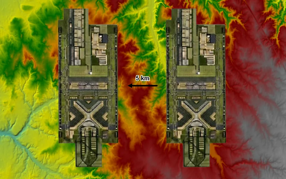
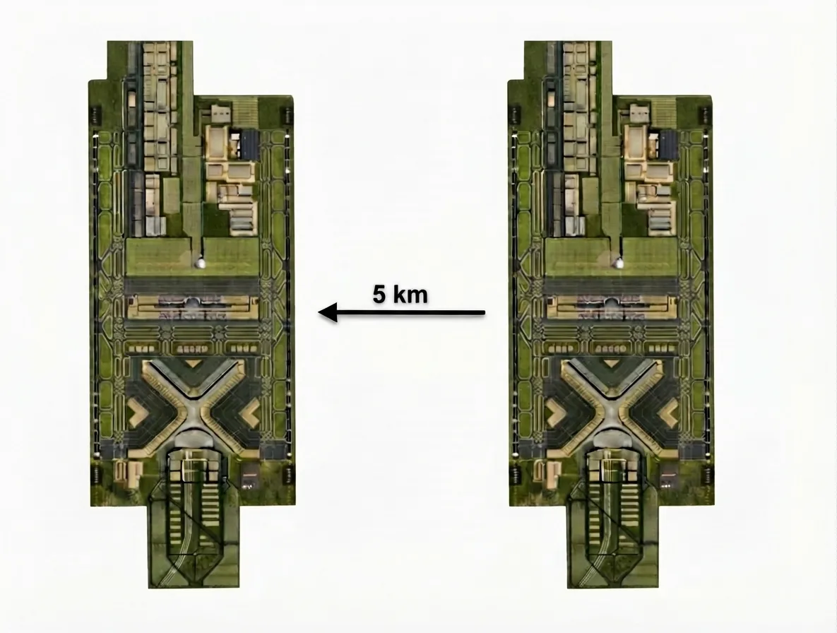
In July 2026, IdroAM compared two layouts for the future Luís de Camões Airport at the Alcochete Firing Range in an independent study commissioned by the Mata do Duque II Residents’ Association. Using two-dimensional hydraulic modelling and a 100-year return-period event, the eastern layout required approximately 21 km of artificial channels and 720,000 m³ of modelled storage; the western alternative required 5.7 km and 140,000 m³. Both layouts are technically feasible. The study does not demonstrate runway flooding, operational shutdown or airport infeasibility, and recommends that the western alternative be examined further in the Environmental Impact Assessment.
What you should know
- The study is independent and does not replace the Environmental Impact Assessment promoted by ANA.
- The 73% reduction refers to the length of artificial channels; the reduction of approximately 81% refers to the modelled storage volume. These are different metrics.
- The results are outputs from a comparative model and depend on the data, assumptions and boundary conditions used.
- The report considers both layouts technically feasible and recommends further examination of the western alternative in the environmental assessment process.
- The useful question at this stage is not whether the risk can be mitigated, but which alternative requires less artificialisation of drainage over its life cycle.
1. What was studied, and by whom
IdroAM compared two airport layouts at the Alcochete Firing Range in an independent study commissioned by the Mata do Duque II Residents’ Association.
Recent news about the hydraulic risk associated with the future Luís de Camões Airport has brought a question requiring rigour into the public debate: how does the location of the airport platform interfere with natural drainage and with the territory’s response to extreme rainfall events?
In July 2026, IdroAM carried out a preliminary and comparative assessment for the Mata do Duque II Residents’ Association of the hydrological, hydraulic and morphological constraints affecting two layouts at the Alcochete Firing Range. This is an independent study and does not constitute the official Environmental Impact Assessment promoted by ANA.
2. What the model showed
The analysis used two-dimensional hydraulic modelling in HEC-RAS 6.6, a digital terrain model with 2-metre resolution and a design event with a 100-year return period — approximately a 1% annual probability of exceedance. In the analysed configuration, the eastern layout showed greater interference with the Vale do Cobrão drainage network and greater dependence on artificial channels.
In the comparative simulations, the estimated channel length fell from approximately 21 km to 5.7 km, while the modelled storage volume fell from approximately 720,000 to 140,000 m³ in the western alternative. The 73% reduction refers to channel length; the reduction in modelled volume is approximately 81%.
3. What these figures do not demonstrate
These figures are model outputs and depend on the data, assumptions and boundary conditions used. On their own, they do not demonstrate runway flooding, unavoidable suspension of operations or airport infeasibility. The report itself considers both layouts technically feasible and recommends that the western alternative be examined further in the environmental assessment process, together with geotechnical and hydrogeological studies, piezometric monitoring and sustainable drainage solutions.
4. Why alternatives should be compared before a decision
For IdroAM, the question is not only whether a risk can be mitigated through engineering. It is to compare, before the final decision, which alternative requires less artificialisation of drainage, depends less on extensive structures, offers greater resilience to extreme events and reduces cost and vulnerability over the life cycle.
5. Frequently asked questions
Who commissioned IdroAM’s study, and for what purpose?
The Mata do Duque II Residents’ Association. The purpose was to understand whether a relatively small change in the platform’s location would significantly alter the infrastructure’s relationship with the natural water system.
Is the study part of the official environmental assessment process?
No. It is an independent preliminary and comparative assessment and does not replace the Environmental Impact Assessment promoted by ANA, which is proceeding before the Portuguese Environment Agency as EIA process 3982.
Does the study conclude that the airport is infeasible or will have to stop operating?
No. The report considers both layouts technically feasible. It identifies relevant hydraulic differences between them and recommends further examination of the western alternative in the environmental assessment process. It does not demonstrate runway flooding, water depth or duration, or interruption of operations.
What do the 80 hectares mentioned in the news mean?
This is the increase in the area affected by flooding in the eastern configuration under the modelled event, concentrated mainly in pockets trapped between the platform and the drainage channels. In the western alternative, the comparable value is approximately 18 hectares. It does not correspond to flooded airport area and does not establish water depth, duration or operational effects.
6. Authorship and credits
Entity: IdroAM Water Engineering.
Technical team: Inês Antunes — CEO · Adriano Murachelli — Technical Director.
Final technical approval: Inês Antunes.
The maps and figures accompanying this note are technical materials produced by IdroAM and published with the company’s express authorisation (19 August 2026, extended on 2 September 2026 to the remaining images in the Italian material).
Commercial contact: info@idroam.it
Report: Read the full technical report (PDF)
7. Sources
- IdroAM, Avaliação preliminar das condicionantes hidrológicas, hidráulicas e morfológicas associadas ao novo Aeroporto Luís de Camões, July 2026. Source for 21 km, 5.7 km, 720,000 and 140,000 m³, 73% and 81%, HEC-RAS 6.6, the 2-metre DTM and T=100 years.
- IdroAM, Hydraulic presentation, July 2026. Source for approximately 80 and 18 hectares and the distance of approximately 5 km between the layouts.
- Portuguese Environment Agency, EIA process 3982 — New Lisbon Airport / Luís de Camões Airport.
- Portuguese Environment Agency, EIA process 2251 — New Lisbon Airport, Preliminary Study, 2010.
- Portuguese Council of Ministers, Resolution no. 119/2026 of 15 June.


